
Some 350,000 years ago, the centre of New Zealand’s North Island appeared much different than the mountainous, scrub-covered landscape it is today.
Amid a glacial period, temperatures were colder and conditions harsher. Vast beech and podocarp forests blanketed the region, providing habitat for abundant native birdlife.
It was against this tranquil backdrop that the one of the Earth’s most explosive eruptions violently unfolded, releasing enough material to carpet much of the country.
Now, colleagues and I have pieced together traces left by the event to provide an unprecedented picture of how it happened – while shedding important new light on the mechanics of those rare cataclysms that are known as supereruptions.
Reconstructing a supereruption
The Whakamaru supereruption was one of the largest ever recorded on Earth – and the greatest produced by New Zealand’s famous Taupō Volcanic Zone.
Stretching from Whakaari/White Island to Ruapehu, this dynamic area is the product of two powerful geological processes: the Pacific Plate sinking beneath the Australian Plate, and the central North Island simultaneously being pulled apart.
It is home to numerous volcanic features today, from geothermal fields with bubbling hot springs and mud pools, to caldera systems and active stratovolcanoes.
Throughout its 2-million-year history, the zone has experienced four known events of such immense scale that they are formally classified as supereruptions – or those that would score a maximum 8 on the Volcanic Explosivity Index.
Only a few dozen have ever been recorded worldwide – the most recent being the Ōruanui eruption that helped create Lake Taupō around 25,300 years ago.
For volcanologists, they pose some of the field’s greatest mysteries: how can so much magma build up below the surface, and then erupt all at once? And what happens to the surrounding landscapes?
To help answer these questions, we turn to preserved volcanic deposits that can be used to reconstruct the processes that play out during these rare events.
Two signature products of supereruptions are “flow” deposits – hot, dangerous masses of rock and gas that travel along the ground – and “fall” deposits, typically mixtures of crystals and volcanic glass that fall from the air.
The challenge for volcanologists is that typically only fragments of these deposits are preserved – and they are often scattered across great distances.
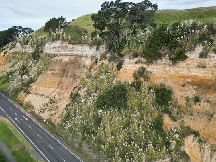
In the Whakamaru supereruption, massive pyroclastic flows left behind thick layers of dense volcanic rock across the Whakamaru and King Country regions. Ash and pumice spread much farther, blanketing much of the North Island and parts of the Pacific Ocean.
One of the first steps in our study was to build a database of these deposits by matching the unique chemical signature of volcanic glass produced during the eruption.
Provided by author, CC BY-NC-ND
This process is similar to forensic science at a crime scene: fingerprints may suggest a suspect, but DNA evidence can confirm the match. In volcanology, deposits can offer clues as to how they got there, but it is their chemical composition which provides the definitive link.
Using this approach, we analysed more than 30 sites around New Zealand and the south Pacific Ocean. All were found to have come from the Whakamaru supereruption.
With these correlated, we were then able to reconstruct this extraordinary episode.
How the supereruption unfolded
At the beginning of the eruption, a large lake likely lay within the central North Island, much like Lake Taupō today.
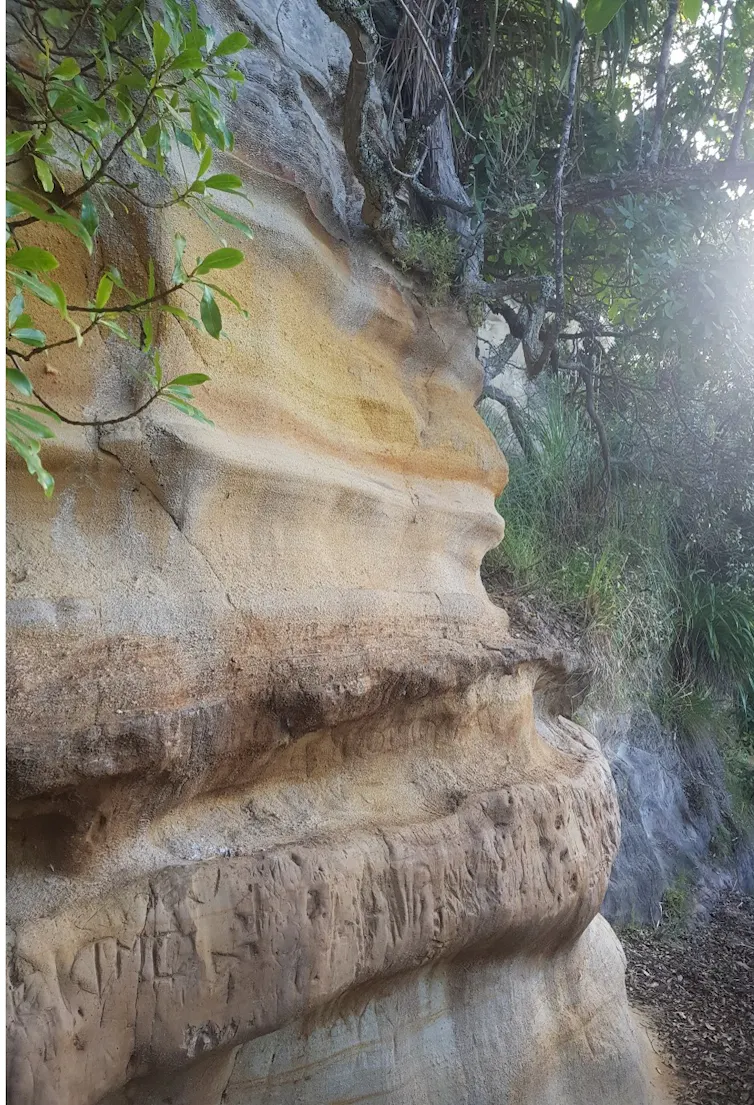
When the magma reached the surface, it erupted directly into this lake, triggering extremely violent interactions between magma and water, which drove the earliest phase of the eruption.
Provided by author, CC BY-NC-ND
It appears this first phase was driven by the evacuation of a singular magma body.
As the eruption progressed, the lake was gradually destroyed and infilled. Eventually, the system transitioned into a much drier style of volcanism.
At the same time, the eruption evolved into a far larger and more complex event beneath the surface. Instead of being fed by one magma chamber, it appears to have triggered a cascading sequence involving at least five separate magma bodies erupting at once.
The amount of ash generated by the eruption is staggering.
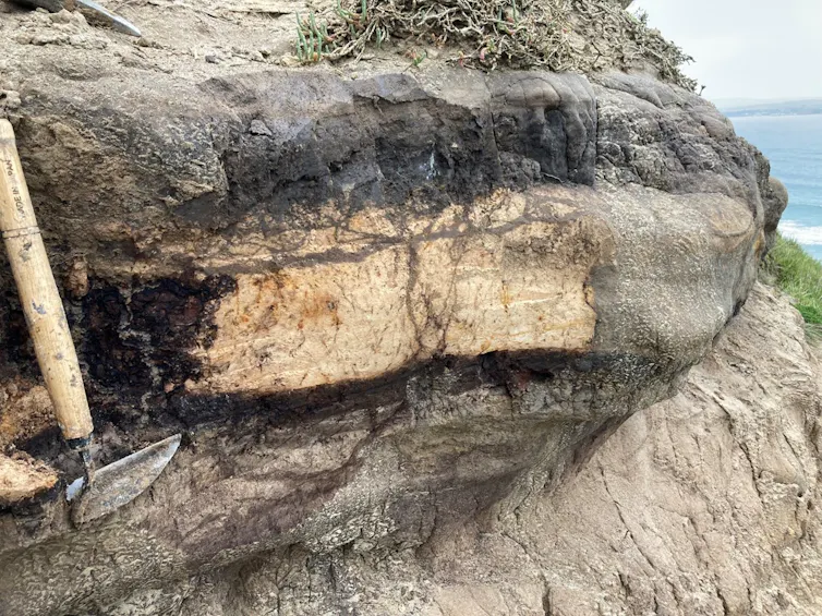
Most of the North Island – and even far-away Chatham Island – would have been carpeted in around 30cm or more of material. Areas closer to the eruption were left buried under as much as 4.5m of ash.
Provided by author, CC BY-NC-ND
Hot, dense pyroclastic flows also swept across the landscape, leaving deposits up to hundreds of metres thick closer to the eruption source.
Altogether, we estimate the eruption released around 2,300 cubic kilometres of volcanic material – enough to bury the entirety of New Zealand beneath roughly nine metres of debris if spread evenly from Cape Reinga to Invercargill.
Provided by author, CC BY-NC-ND
Today, the Taupō Volcanic Zone remains one of the most active and powerful volcanic systems on Earth.
Although supereruptions like Whakamaru are rare, Taupō volcano has produced many smaller yet still devastating eruptions throughout its history, all of which would have had major impacts on both New Zealand and the wider world.
Understanding how these types of volcanoes operate is essential, both in preparing for future eruptions and for understanding how past events may have transformed the landscape we see today.
The author acknowledges the contributions of Simon Baker and Colin Wilson to this research.

The post “A ‘supereruption’ transformed NZ 350,000 years ago. We now know how it happened” by Anna Miller, PhD Candidate, School of Geography, Environment and Earth Sciences, Te Herenga Waka — Victoria University of Wellington was published on 05/27/2026 by theconversation.com